Rambling On Blog
22/12/2025
FEBRUARY 2025 - RETURN TO THE HOWGILL FELLS
A second visit to the Howgills over 2 days, staying in my van overnight
For years I’d driven north on the M6, always glancing to the right at the mysterious green hills of the Howgills and wondering what lay beyond them. This year, I finally decided it was time to stop wondering and start exploring. My first visit was back in January, when I walked up alongside Cautley Spout (you can read about that trip here...), and it didn’t take long for me to realise just how special this area is.
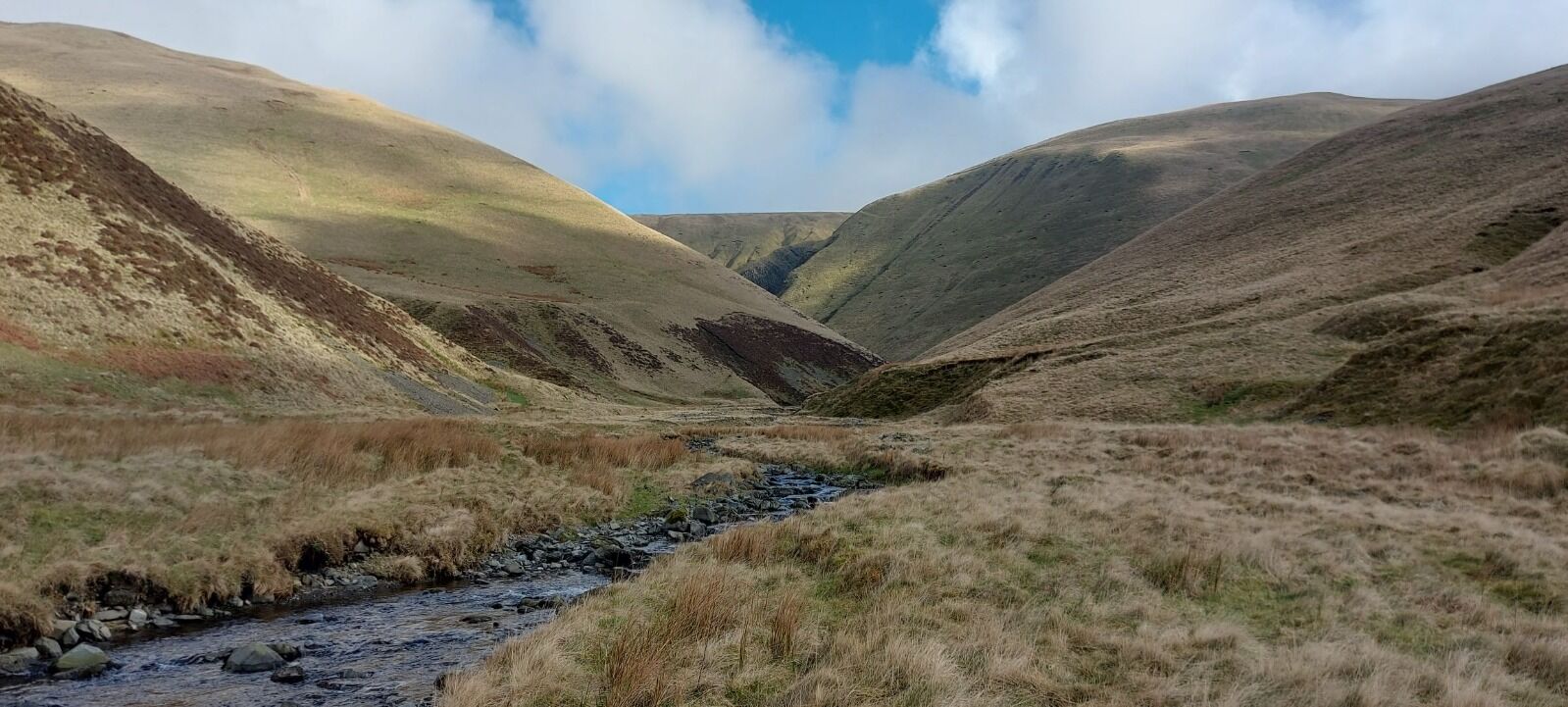
The Howgills really are one of Cumbria’s best-kept secrets. Now part of the Yorkshire Dales, they’re a range of rounded grassy hills, divided by steep-sided valleys. Walking here is an absolute joy. The grass underfoot makes for easy progress, and the long, sweeping ridges allow you to cover good distances in a relatively short time. Don't be fooled thought because it’s not all gentle wandering as those valleys are steep, and linking summits can involve a fair amount of climbing, descending and reasending as I found out on this trip. The effort is always worth it though.
One of the things I love most about the Howgills is how quiet they are. On my last visit I saw very few people; on this trip, over two full days of walking, I didn’t see a single soul. It felt remote and peaceful.
Long before the motorway came along, the Romans built Fairmile Road along the base of the hills. it’s now a quiet tarmac lane, and it was here that I found a perfect park-up for the night, a peaceful layby overlooking the M6 on one side, and the looming fells on the other. Its quite a contrast! When I drive past the Howgills now I look up to the place where I was parked that night.
My first walk began from the same starting point as last month, near Cautley Spout, but this time instead of following the path alongside the waterfall, I headed straight up Yarlside. It was a steep slog from the outset, but once again I was blessed with beautiful weather. There was still a dusting of snow on the tops, which had Nala tearing around in full zoomie mode.
From the summit of Yarlside it was a steep descent into the valley to Bowderdale Beck, where I stopped for a while, soaking up the sunshine before tackling what turned out to be a very steep ascent up Randygill Top. That climb felt endless, with lots of false summits …don’t you just love a false summit! Eventually, though, I reached the top with a huge sigh of relief.
From there the walking eased into a pleasant, undulating stroll across to the trig point on Green Bell, one of the four trig points in the Howgill Fells. After stopping to enjoy the views , I began to retrace my steps. Rather than reascending Randygill Top, I diverted instead to Kensgriff, a lovely summit in its own right. From there, I skirted around the slopes of Yarlside , where I’d been earlier in the day and eventually rejoined my outward route.
Back at the van, I drove into Sedbergh and stopped at their excellent Spar shop to stock up on supplies before heading round to my quiet park-up overlooking the M6, where I would be starting tomorrow’s walk from.
.
.
The next morning I woke to a van coated in frost. It was bitterly cold, and it took some will-power to crawl out from under the covers. I got myself moving as quickly as possible, coffee, a few star jumps outside, and then straight into walking mode. I knew that the sooner I started, the sooner I’d warm up.
The first part of the walk followed the valley floor alongside Carlin Gill, and we stayed in the shade for a while but as I climbed higher and joined the path up towards Linghaw, we emerged into the morning sunshine and it wasn’t long before I was feeling too warm!
It was a stunningly beautiful morning. Out towards the Lake District there was a semi-inversion. It was just stunning
What followed was a wild and wonderful day of walking. Snow still lingered on some of the higher ground, and it was a joy to move so easily along the long grassy ridges, linking summit after summit, though the ascents and descents were pretty steep. Over the course of the day I ticked off a nice long list of tops: Knowles, Linghaw, Fell Head, Breaks Head, Bush Howe, White Fell Head, Windscarth, Bleagill Head, Wethercalf Moss, Simon’s Seat, Middleton (with its trig point), Taffergill Hill, Over Sale, Docker Knott and Hand Lake.
From the final summit, I descended into the beautiful Blakethwaite Bottom, before joining a rather sketchy path across Black Force Screes. It was here I started questioning my decision tp take this particular route. The path was narrow and eroded, with a very long drop below and I wasn’t sure it was the path I should have been on. The views, however, were phenomenal: a dramatic gorge of crags and scree, a complete contrast to the grassy, rolling hills I’d been walking all day.
As impressive as it was, I felt a sense of relief when I was finally back on grassy terrain, leaving the sketchy path behind. From there it was a steep but straightforward grassy descent back down to Carlin Gill, and then a gentle walk through the valley to return to the van.
After a coffee and a bite to eat, I set off for home. The M6 was closed due to an accident, meaning a long diversion. It turned out to be a lovely detour though, winding through villages and landscapes I’d never have seen otherwise, even if it did make for a long drive home after an already long day on the hills.